Home
About
Us
Projects
Clients
Email Us
31 School Street
Hyannis, MA 02601 USA
Phone: 508-827-4169
Cell: 508-221-8620
Fax: 508-957-2191
Email Us
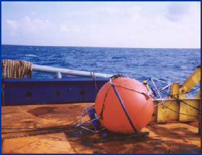
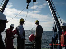
Deep Water Ocean Current Measurements at the (confidential) location Makassar Strait, Indonesia
December 2001 to January 2003Ocean Data personnel were again requested to design and install an additional mooring system for Unocal Engineering & Construction group for purposes of quantifying annual variability at a proposed production platform location in approximately 1610 meters water depth. Ocean Data again provided Unocal a continuous 14-month data set (409 days) of deep water ocean current measurements. This program required high-resolution measurements of nearsurface layer, a challenge in such deep water. To meet the challenge, Ocean Data designed a system to measure the energetic surface layer with high (4-meter bin) vertical resolution, and measure deeper currents with lower (8- meter bin) vertical resolution. The lower water column was dotted with single-point meters, as well as a high-resolution tide gauge. The ADCPs captured the upper 800m of the water column, recording vertical profiles every 20 minutes throughout the program. Data return for the entire program was not as bright as previous programs, still better than 92%, due exclusively to a failure of one instrument for an entire 4-month deployment (premature discharge of the alkaline battery). The final report was delivered to the client April 30, 2003, 101 days after the data were recovered at sea